La Plateforme Digitale Collaborative (PDC) : un outil numérique au service de la gouvernance urbaine au Cameroun
Cette plateforme vise à renforcer la gouvernance urbaine au Cameroun en facilitant la mise en réseau, le partage d’informations et la transparence entre les multiples acteurs du développement des villes. La PDC représente la brique numérique du projet PUC, et constitue une avancée majeure dans la structuration des données et la collaboration entre institutions, collectivités, bailleurs ou acteurs techniques.
Cameroun : un contexte urbain en pleine mutation
Avec une population urbaine qui s’élevait à 55 % en 2020 et projetée à 70 % d’ici 2050, le Cameroun connaît une urbanisation rapide, marquée par de nombreux défis : pression sur les infrastructures, informalité, pollution, mobilité réduite et vulnérabilité accrue face au changement climatique.
Pour répondre à ces enjeux, l’Union européenne soutient le programme « Cameroun – Villes vertes, inclusives et durables », doté d’un budget de 24 millions d’euros, dont l’un des axes vise à renforcer la gouvernance à travers des outils innovants. C’est dans ce cadre que CartONGa participé au développement de la Plateforme Digitale Collaborative (PDC).

Un outil pour connecter les acteurs de l’urbanisme
La Plateforme a pour vocation de centraliser les informations sur les projets, acteurs et ressources liés à l’urbanisme au Cameroun. Elle permet aux utilisateurs, collectivités, bailleurs, techniciens, chercheurs ou associations, de :
- Se mettre en relation facilement,
- Accéder à une base de données de référence
- Visualiser/spatialiser les informations sur une carte,
- Collaborer autour de projets urbains,
- Valoriser les bonnes pratiques locales.
Elle a été conçue de manière participative, avec un objectif clair : favoriser l’appropriation locale et permettre sa gestion autonome par une communauté nationale d’utilisateurs et d’animateurs.
Le DiverCity Space : un espace au service de l’innovation urbaine
Le DiverCity Space est un tiers-lieu de 250 m² ouvert à Yaoundé par le Ministère de l’Habitat et du Développement Urbain. Conçu comme un espace de dialogue, d’expérimentation et de formation, il réunit les acteurs urbains (institutions, chercheurs, citoyens, innovateurs, etc.) autour des enjeux de transformation territoriale. Bien que CartONG n’ait pas été impliquée dans sa mise en place, cet espace est pleinement complémentaire de notre plateforme PDC. Le DiverCity Space propose une dynamique physique d’animation locale, et la PDC permet de prolonger ces échanges, de capitaliser les données produites et de structurer les connaissances pour éclairer la décision publique. Ensemble, ils forment un dispositif cohérent pour accompagner les villes vers une gouvernance plus inclusive et fondée sur les données.
Une communauté d’usagers formés et engagés
Développée selon une approche agile et participative, la PDC a permis bien plus que la création d’un outil : elle a participé à structurer une véritable communauté locale, active et formée, contributeurs, administrateurs, développeurs, capable de gérer, enrichi et faire évoluer la plateforme e manière autonome. En rassemblant lors des ateliers, cette communauté locale joue un rôle clé dans la pérennité et le dynamisme de l’outil.
Et maintenant ?
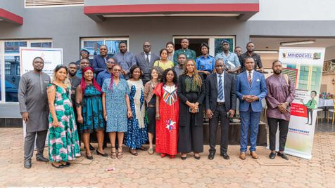
La version 1 de la plateforme a été lancée lancée jeudi dernier lors d’un évènement organisé par Expertise France avec les acteurs locaux et les autorités nationales à Yaoundé. Les prochaines étapes incluent :
- La contribution de la communauté pour assurer l’enrichissement de la base de données,
- L’élaboration d’une feuille de route pour une nouvelle version, capitalisant sur les retours utilisateurs
La plateforme est conçue en open-source, afin de favoriser sa réplicabilité a différentes échelles (ville, région, etc.) ou autres dans d’autres contextes ou thématiques, comme la santé ou l’environnement.
La clôture de ce projet marque l’aboutissement des efforts collectifs de notre équipe webdev. Au-delà de la simple livraison d’une solution, ce projet a non seulement renforcé notre cohésion et enrichi nos compétences, mais il a également ouvert de nouvelles perspectives pour des innovations futures.