Follow-up to Humanity & Inclusion’s GIS needs assessment
Compared to the majority of English-speaking western NGOs and International Organizations, most French NGOs can be seen as being rather behind in their approach to and use of geographic information. This is due to a great extent to the digital turn not having been as significantly marked for the sector as in other countries. Improving the use of mapping as a vector for enhanced spatial understanding of field situations has indeed rarely being seen as a priority by NGO headquarters in France, who thus tend to under-invest in it (and more generally speaking in Information Management topics) both financially speaking and in terms of human resources.
A request for support from Humanity & Inclusion
The situation has long been acknowledged at Humanity & Inclusion (HI). In 2019, the Innovation, Impact & Information team of HI thus decided that it was time to invest the topic and undertake a GIS needs assessment on HQ and field operations. The idea of this 3-week assessment was also to delve further into the current usages and practices at HI, so as to come up with practical short-term and longer term recommendations. Having a long experience in both the use and implementation of GIS for the humanitarian sector, as well as in conducting various formats of needs assessments, CartONG was selected for the project.
For this needs assessment, CartONG interviewed the key players to identify their current usages and practices, as well as their expectations, fears and difficulties in terms of geodata and geoproducts. We also reviewed the GIS-related documentation and tools used by HQ and field operations. The result of this needs assessment was a report that CartONG sent to HI giving an overview of the current situation and needs, with a list of short and long-term recommendations and potential scenarios.
Key findings of the GIS needs assessment conducted at HI
One of the key findings of the assessment conducted by CartONG was that there was no immediate need for a holistic approach used throughout all programs for the establishment and use of geo-data in HI – like some organizations require – as many of their 27 sectors of intervention do not have a strong spatial component. In other words, the short-term needs were mostly centered around a couple of key sectors as well as more transversal support functions.
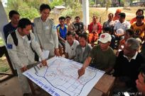
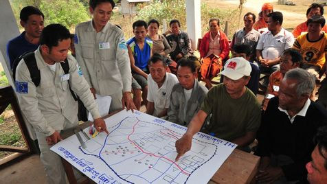
Driven in part by a strong use of GIS and drones in the Reduction of Armed Violence sector (in particular to identify mined areas), the use of geodata and geoproducts in HI was found to also be relevant at field level for Disaster Risk Reduction projects, as well as for the mapping of natural hazards extent, the localization of vulnerable populations, crisis management, the mapping of post-catastrophe risks and the preventive mapping of risk reduction plans. It was also clearly identified that support entities at HI (such as Security and Logistics & Supply – for which HI is a mutualisation entity for the sector with their Atlas Logistique entity) were also in demand of further using GIS in their every work.
At HQ level, the GIS needs identified were linked to supporting contextual mapping as well as less-operational topics such as communication, reporting and advocacy. They were seen as key to support more adequate spatial knowledge of man-made or natural disaster situations, efficiency of action, as well as accountability.
Beyond the study of the in-house practices, CartONG conducted a thorough analysis of the situation and needs of the strategic (internal and external positioning and investment, ownership/place of GIS, technical strategy, etc.), organizational (institutional policy/framework/procedures in place, dedicated roles and responsibilities, etc.), human (level of horizontal and vertical dissemination of GIS, available and needed skills, knowledge and culture, etc.) and technical (compatibility of IT infrastructure with GIS needs, field connectivity constraints, etc.) components.
Looking beyond the specific situation of HI: 6 key recommendations for NGOs in the sector
- Recommendation 1: Have a clearly identified GIS entity in HQ
It is important for field operations to feel that there is an entity in HQ that can support them in case of questions and help structure their work – even if in the short term, for budget reasons, this only corresponds to a part-time position or a position that then relays with an external specialist entity.
- Recommendation 2: Win field acceptance though quick-wins
When GIS is seen as something too complex to implement and maintain for day-to-day wear – in particular in an organisation that is not yet at a high stage of maturity in terms of usage of GIS tools – it is important to concentrate on small(er) initiatives that can make a difference. This should include small tools or reproducible methods calibrated on clearly identified needs – in the case of HI, some of these included a Google Earth template project for analysis of a security situation, a uMap or OSMAnd tutorial for small scale unstructured data collection or visualization or an ArcGIS Enterprise webmap representing key indicators for a country.
Thinking wider and grander – which proves useful in the long term – can actually be counter-productive in the short term, as any organization needs to go through a certain level of change and acceptance before it can truly be ready for a more holistic approach with more advanced tools.
- Recommendation 3: Build on an emergency as a catalyst for change
In the past, the GIS onboarding of an organization has often been built in relation to a key event or crisis that showed the full potential of geographic data for more efficient decision-making in fast-changing situations. This was the case, for example, of the high profile 2011 Haiti earthquake that was a game changer in terms of making open geographical data available with a sharp increase in the use of OpenStreetMap or of the 2014 Ebola crisis that lead organizations such as MSF to develop a GIS strategy and set up a GIS unit. Unfortunately, there is nothing more powerful than such a catalytic publicized event to build awareness – at all levels of an organization or even in the sector as a whole- on the relevance of such approaches for data-driven decision-making in emergency situations. Such events also push humanitarian actors to be(come) more prepared in terms of skills, data, resources and processes to ensure an adequate answer.
- Recommendation 4: Ensure top management endorsement and sector sponsors
Once the geographic seeds have been planted for an organization, it will still require a significant level of change in practices and organizational endorsement to move forward in a more structured fashion. As it both touches on different sectors and aspects of the said organization (be it HR, technical expertise, or monitoring and evaluation) and requires an initial investment for it to take off, furthering the “cause of GIS” internally usually necessitates a strong “sponsorship” by top management. Such a support will help staff perceive the changes being undertaken as long-term game changers that will make the work of some of the services or sectors more efficient, by helping them improve their understanding of a situation through geodata.
- Recommendation 5: Facilitate staff’s access to existing internal and external GIS resources
To ensure that whatever is already available and useful in terms of geoproducts, geodata or approaches is indeed beneficial to operational teams (be it internal or external resources), it is recommended that a clear workflow for dissemination be determined. Such a workflow should be based on the knowledge management and Information Management tools and strategy of the organization.
Beyond this, there already exist external geodata and geoproducts humanitarian repositories that just need to be better known by relevant staff to become useful: this is the case of Reliefweb, HDX and OpenStreetMap for instance. These resources can be better made known through reminders on internal communication channels, sharing of the key resources through the internal resource-sharing platforms and, also, through formal or less formal feedback sessions on the use to which was put this external data.
- Recommendation 6: Invest in a couple of sectors with high added value
Our last recommendation is to focus first and foremost on a couple of sectors for which the added value in terms of geo data and products is unquestionable – this will help with the general organizational adoption of GIS.
For any NGO wishing to follow these recommendations, it is important to mention that integrating the spatial dimension into existing information systems, methods and tools of an NGO represents a considerable effort and should be thought through carefully and holistically.
Following the assessment, what’s next for Humanity & Inclusion?
The assessment conducted in September and October 2019 by CartONG was a first step for HI to gain a better understanding of their current situation and needs in relation to GIS. As part of the report, a number of scenarios were presented to HI combining all recommendations, both at an organizational level (dissemination of a mapping culture across the organization, set-up of a fully-fledged GIS solution, etc.) as well as at a smaller scale.
Some of these smaller scale implementations are already planned out for implementation in 2020. For the larger scale and more complex ones, implementation would require a wider organizational process that would – if organizational endorsement occurs – probably take several years before paving the road to a widespread use of GIS in HI.