Participatory mapping for food security
Overall, the project had 3 main objectives:
- To guarantee the production and processing of up-to-date and accurate geographic information using tools adapted to the profiles and capacities of our partner,
- To better understand and take into account people’s needs and ease collaboration with local communities through the use of participatory mapping tools,
- To encourage collaborative work among various stakeholders through information sharing and the implementation of sustainable data management tools.
To this end, we developed a hybrid methodology which would allow to develop the capacity of SIF teams and strengthen the OpenStreetMap Madagascar community contributing to the project, as well as include remote and in situ data creation on OSM, and participatory workshops with local communities.
Needs assessment and first mission
The project was initially supposed to be carried out over the course of 2 years, but the Covid-19 pandemic deeply impacted its implementation: we were only able to really start our support to SIF in the fall of 2021 when Madagascar’s borders reopen, with only 6 months remaining.
The first step was to discuss – remotely – the expectations and capacities of SIF: while their teams were already working with communities in a participatory approach, they had no mapping skills and limited experience in data management (household surveys only).
CartONG also completed the highly incomplete basemap of the area during several collaborative mapping events, also called “mapathons”. For this project, we had no less than 165 contributions spread over 31 mapathons. This valuable support from our volunteers allowed the mapping of 37,235 buildings and 4,322 km of roads and paths on the HOT Tasking Manager.
We then organized a first mission in December 2021 with the aim of both assessing the capabilities and needs of SIF, and conducting an initial training. To do this:
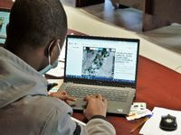
- A member of the OSM-MG community trained a group of 17 students from the University of Toliara gathering different academic years (L3, M1, M2, PhD students) and specialities (70% of students in geography and 30% in economics, agronomy and livestock farming) on the whole OSM contribution chain (concepts, contribution on JOSM, OsmAnd and Fieldpapers, data integration/processing). Despite the “usual” technical difficulties (linked to hardware, wifi connection, etc.), the students loved this training, which allowed them to make a greater use of the tools they already have (PC, smartphone) in their studies but also in their future careers.
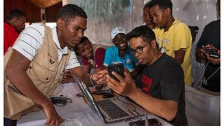
- A CartONG staff was deployed to Morombe to train SIF’s teams (20 technicians from the food security project but also from other projects) in OSM mapping (on satellite imagery with JOSM and in the field with OsmAnd). The training was a success, even though it took some time to set up and use the tools for technicians who were not used to working with computers and/or who had older equipment. What’s more, the practice run on OsmAnd organized during the training allowed the collection of 80 points of interest in the city of Morombe.
The mission also helped clarify the expectations of and resources available to SIF (via a workshop), and allowed us to co-develop the methodology of the participatory mapping workshops:
- The workshop “the name of the maps” allowed SIF’s teams to identify the 3 maps that would be the most useful for their work – by clarifying existing needs, potential uses, necessary data and the types of rendering desired – on 3 main topics (food security, risks and education – the last 2 are not part of the current project but can be reused by SIF at a later stage). This allowed SIF, with the help of CartONG, to synthesize the need around 5 maps: reference map; water resources map; map of economic activities and types of crops; map of farmer field schools (FFS) supported by SIF; and map of markets.
- This workshop was completed by a collaborative session to develop the methodology of the participatory mapping workshops: based on the examples of participatory and sensitive mapping workshops presented by CartONG, an outline and a list of questions were established to complete the data required for the desired maps.
Follow-up and second mission
Following this first mission, we prepared the methodology of the workshops, by creating the maps that would be used during the workshops. At the same time, we tried to make the students and the SIF team practice remotely, even if time constraints and the context did not allow us to go as far as we hoped so.
During this time, we assessed what was the best option for map renderings was:
- Paper PDF maps, edited on QGIS by CartONG, and printed in large format to be left on-site. This had the advantage of being easily readable and usable offline in all municipalities, including rural ones. The downside was that these maps were static and SIF was not trained on QGIS and therefore could not update them after the end of the project.
- Simple dynamic maps, edited on uMap, which would be automatically updated with every edition of the SIF team (either via the OSM database or by adding specific points). The advantage was the possibility to update, the disadvantage being that this tool was much less readable (not properly printable in a large format, need for a computer/internet connection to consult them, etc.).
Following discussions with the SIF team, and given the importance for the communities and local actors to have access to the data they would have contributed to create, paper maps were opted for.
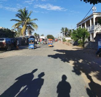
After a preparation period in Antananarivo, the CartONG/OSM-MG team deployed again to Morombe in February/March of this year, joined by the group of students trained on OSM, for a collection mission in the 6 municipalities of the project. The program was as follows:
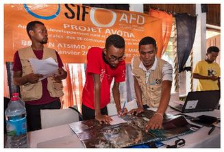
- Training of SIF team and a group of students from Toliara to co-host community mapping workshops (in Morombe)
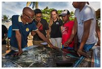
- Co-facilitation of a pilot workshop in a first municipality by the whole CartONG/OSM-MG team (as facilitators), SIF and the students.
- The SIF team and students were then splitted into two groups, each would then co-facilitate 2 workshops in 2 municipalities, with CartONG and OSM-MG each acting as facilitators for one of the group.
- Facilitation of other community workshops by SIF and students with remote support from CartONG and OSM MG.
Despite the logistical challenge, the collaboration was very smooth between the students and the SIF team, drawing on their respective technical and field expertise. The technical problems encountered in the field were all solved as they arose, confirming that a thorough field data collection phase is necessary after the training for proper appropriation – while operating 100% remotely remains far less efficient.
Results of this project
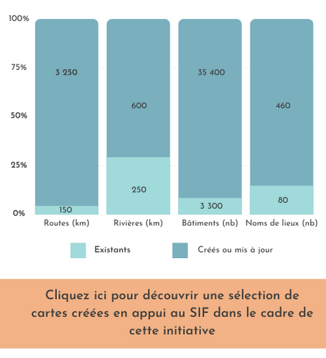
The data collection allowed the integration to OpenStreetMap of 516 points on the 6 municipalities, a quantitative contribution but also and especially qualitative, which will be useful both to the SIF project and to all actors of the territory (development agencies, governmental organizations, but also tourists or visitors). This is clearly visible, taking the example of a village covered in an exhaustive way like Ambahikily, which in addition to a complete base map (road and hydrographic network, urban tasks, buildings), also includes all the key points of interest of the territory linked to transportation, health, worship, trade, etc.
Data collection being conducted both remotely and in the field has resulted in a very significant addition to the basemap of the territory, as evidenced by the opposite figures, comparing data created before July 2019 / since July 2019 (project period).
In parallel, team workshops were held to raise awareness about mapping and to use the local population as a direct source of information for understanding territorial dynamics. Participants contributed to three maps: activity types, crops and hydrography, and food dependency systems. The completed maps produced the dense and comprehensive material included in the final deliverables of the project, and the participants took great ownership of the methodology and were delighted to have their field expertise taken into account.
19 final maps were produced after the second mission and grouped the information on the 6 communes (by type), with the addition of a map at the district level and a map containing the feedback from the workshop on food dependency.
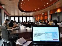
Finally, a feedback workshop was organized in Antanarivo for about twenty participants (professionals, NGO leaders, students, members of the local OSM community).
To go further: a few learnings
In conclusion, in spite of a highly disrupted agenda, the project fulfilled most of its objectives, and allowed for various interesting learnings. From a technical point of view, the use of OpenStreetMap has once again extremely positive, and the coupling with the participatory workshops “on paper” has allowed a relatively exhaustive coverage of the data collection, despite the complicated field conditions. Working exclusively with open source and low-tech tools (no server or software dedicated to the project) has thus proved its worth even for a large-scale NGO. The initial objective of empowering SIF in the use of OSM tools could not be fully achieved due to the short timeframe, which raises the question of the relevance of such a comprehensive training for a short project. Nevertheless, the acquired skills will be useful beyond this particular project, and the repetition of such projects would ensure their sustainability.
Partners and communities have favored paper maps which are more usable locally than dynamic (or web map) solutions, however editing them is much more time consuming. Eventually, CartONG would like to develop an easily deployable web mapping tool that generates customizable PDF maps, which would take the best of both solutions – we are actively seeking funding to move forward on this aspect.
The budget, especially in a context of unpredictability of many costs, was too limited to allow us to go further on different aspects (sustainability, transfers of skills, capitalization, comparative study of different methods, etc.). Despite the efforts of SIF to ease logistics and implementation on the field, the project resulted in significant additional costs covered by CartONG, which is not sustainable in the long term.
The cooperation with OpenStreetMap Madagascar was crucial to the success of this project, but various factors (emergency, time lag between the writing of the project and its implementation, evolution of the community) did not allow for the shared implementation – in the leadership of the project – originally planned, which led to some frustrations and further challenges. Implementing an ambitious data collection project in the field, training and accompanying an operational partner with limited experience in data issues, and at the same time working in partnership and supporting the development of a local OSM community: combining all three aspects – with a limited budget – became an almost impossible task.
In line with our 2022-2024 strategy, we would like to design these projects differently in the future, with a more assertive leadership from the local community and CartONG acting mostly as support, although this may prove contradictory to the urgent and operational imperatives of our humanitarian partners. We thus hope to continue this ongoing reflection throughout the implementation of our first strategy, through exchanges with other organizations facing the same contradictions (notably during the 2022 GeOnG forum) and, as always, by listening to our partners from local OSM communities.