Fighting climate change in Tajikistan
About
Description
CartONG initiated a project funded by the German Development Agency (GIZ) in February 2021 to address climate change through participatory mapping in rural Tajikistan. The project, which involved local communities and community-based approaches, used geographic information and open-source technologies to increase the production and availability of geographic information for vulnerable regions.
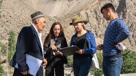
To achieve this, CartONG supported Little Earth, a local environmental NGO, in learning how to use several open-source tools such as OSM, Tasking Manager, JOSM, OsmAnd, and FieldPapers, as well as with the organization of mapathons – participatory mapping activities. Two of CartONG’s staff were deployed to Tajikistan for a short mission and a third one for a few months to work with Little Earth on different project activities. Little Earth then introduced remote and field mapping techniques to various groups of interested people, in Dushanbe and in selected villages.
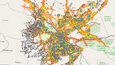
The mapping process was divided into two phases: remote baseline mapping through mapathons, where prominent features like buildings, roads, and rivers were traced on satellite or drone imagery, and fieldwork, where on-the-ground data related to disaster risk preparedness and response was collected. OsmAnd and FieldPapers were employed to facilitate integration into the OpenStreetMap database. A total of five villages were mapped.
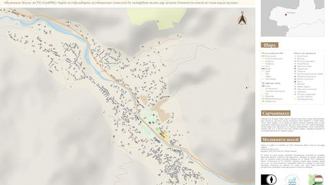
The project also included workshops on climate change awareness raising and discussions on adaptation measures through subjective mapping exercises. Communities were asked to draw maps of their villages and identify places or livelihoods most at risk or affected by natural disasters or climate change. This engaged local communities in the reflection and decision process, creating a comprehensive analysis of disaster risk reduction and climate change adaptation stakes in target areas. Large printed maps of villages were handed over to the local authorities and stakeholders, and raw data was published on the National Spatial Data Infrastructure of the Republic of Tajikistan, enhancing accessibility for all interested parties.